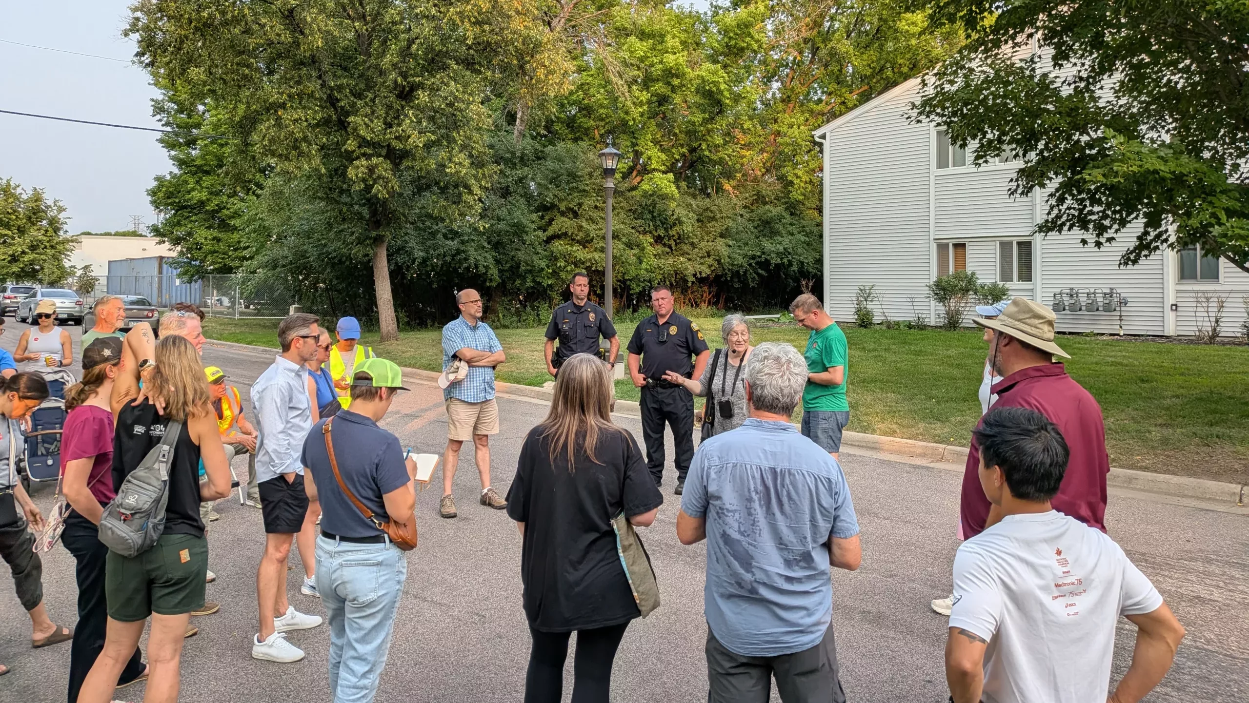
Walking tours can be a fun way to learn about your neighborhood. I was part of a recent Highland District Council Transportation Committee tour of pedestrian issues on West 7th, providing history and context to the conversation. In the past I also led the neighborhood trolley tours during Highland Fest.
These notes are compiled from those tours, so you can also travel along and learn about the area around West 7th Street in Highland. This first part starts us near Fort Snelling.
When we travel through a neighborhood, especially an older city neighborhood, it’s good to remember a few things:
- Streets in a community can change names and in some cases, locations.
- Streets can change functions over time.
- Streets can change the communities around them.
St. Paul’s street name and history “bible” is the book “On the Street Where You Live” by Don Empson, a longtime West End resident. We drew a lot of information from that book and from other Highland and West End history accounts before we began our latest walk.
A lot of current streets have their roots in trails used by Native communities and later as routes to and from Fort Snelling. That includes West 7th and Snelling Avenue. Other streets draw names from the earliest farming families that lived along them, including Davern Street. The Davern family home is beautifully preserved and is a historic landmark not open to the public.
Remember how central the fort was to how the region developed, how people got to and from there, and how the expansion of the reservation north of the fort shaped our city as “squatters” were pushed away and then settlers came in.
Many good books have been written about the fort and its early commandant, Josiah Snelling. One I like is “Fort Snelling: Colossus of the Wilderness” by Stephen P. Hall.
West 7th is a co-named street and is also known as Fort Road because it has served as the main route to and from Fort Snelling. But it was not our only Fort Road or road to the fort. The earliest travelers from the nascent St. Paul settlement used trails or dirt roads closer to the bluff, using sections of what are now Stewart Avenue and Cliff Street, among other streets.
Our current road to the fort became well-established, especially as the streetcar line went in in the 1880s. Our first streetcars were horse-drawn, starting in 1884. The conversion to electricity was in 1891. That also was when streetcar travel was extended the entire length of West 7th.
Buses replaced streetcars in the 1950s, with our streetcar line replaced with buses in 1952.
If you like streetcar history, a great book is “Twin Cities by Trolley: The Streetcar Era in Minneapolis and St. Paul” by John W. Diers and Aaron Isaacs.
You can also search YouTube for videos based on their work.
We didn’t get to visit the overlook on our walking tour but make time to see it if you haven’t done so. Vehicular travel is limited, but it’s easy to get there along the Samuel Morgan Trail or the Mississippi River Boulevard Trail.
The overlook’s bluff face is an old bridge abutment. (Remember the point about streets moving.) The views of the valley, Fort Snelling and the confluence of the Mississippi and Minnesota rivers are stunning. Note the stonework on the plaza and interpretive panels. Give a hat tip to artist Philip Rickey and the city’s then-senior landscape architect Jody Martinez. The interpretive panels are remarkably interesting. Don’t forget to look down and see the story in the plaza stones!
Before you start your walk, give a wave to the Highway 5 Bridge, which opened to traffic in 1961. Its predecessor bridges were built in 1880 and 1909, according to the Minnesota Department of Transportation (MnDOT).
If you start walking on West 7th toward downtown, you’ll note a partial cloverleaf intersection and an Edgcumbe Road overpass that provides access to and from neighborhood streets. That design has been studied and debated over the years but has been left unchanged. There’s just not a lot of space to make physical changes.
You’ll pass a short neighborhood street named Gannon Road. This is a name change example. Before it became Gannon Road, the street was named West 7th Boulevard. The stretch had become a frontage road of sorts as the route of West 7th shifted and changed.
The Gannon’s owners lost extensive street frontage when the current Highway 5 bridge and interchange construction took place in the early 1960s. They sued the state, going all the way to the Minnesota Supreme Court. The case was considered a landmark as the high court ruled in favor of the property owner’s right to compensation for substantial loss of access. But a new trial was ordered due to instructions given to a lower court jury.
West 7th Boulevard became Gannon Road at the request of the restaurant owners. Gannon’s closed in 1991. Would the St. Paul City Council allow a business to name a street after itself now? That is anyone’s guess.




Leave a Reply