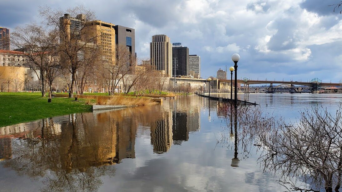
On April 24, The Mississippi River saw the highest water levels since 2019, closing portions of Shepherd and Warner Roads and multiple parks, including Crosby Farm Park, Harriet Island Pavilion and Dock, Hidden Falls, Victoria Park and Upper Landing. The city’s impound lot was also temporarily relocated for the duration of the flooding.
According to the City of St. Paul, the river reached a flood stage of 17.93 feet, just missing being one of the top-ten largest flooding events on the Mississippi in St. Paul, though the crest is expected to reach nearly 19 feet at its peak, potentially putting it into the largest floods on record. Major flood stage is considered 17 feet.
This year’s flooding is so far the 15th largest historic highwater mark for the river in St. Paul. The expected crest of 18.7 feet would fall just short of the 19.02 foot crest in 2011 to put it into the top 10 floods recorded, according to the National Weather Service. This year’s flooding is expected to be well shy of the all-time record for high water along the Mississippi from the 26.01 feet recorded in April of 1965 and about a foot below the 2019 mark of 20.19 feet.
City officials expect the closures to continue until flood waters recede and everything can be cleared and safely reopened for public use. In the meantime, they ask that the public not cross any barricades and use caution when exploring areas near the river.
Keep up with the latest flood information: stpaul.gov/departments/emergency-management/flood-information


Leave a Reply