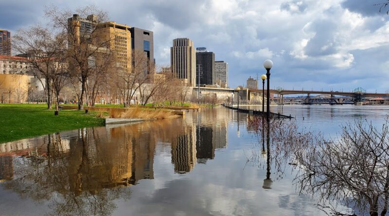
St. Paul closes parks, roads due to flooding
Recent spring rains have caused rising water levels along the Mississippi River through St. Paul, which once again caused closers along the path.
Beginning June 23, Shepard and Warner Roads were closed between Eagle Parkway and Highway 61 to all traffic due to rising water levels.
As part of St. Paul’s flood response plan, the city is contacting property owners along the river who might be impacted, as well as the HART team who is working with any unsheltered or encampments that might be currently located in areas that are prone to river flooding.
Additionally, several parkland areas, trails, and facilities have temporary closures. These include the Hidden Falls boat launch,Kelly’s Landing, Lambert’s Landing Dock, Lilydale Regional Park, including Water Street, pedestrian and bike trails, the dog park, and public boat launch and Meeker Island trail and dog park.
Low-lying trail sections within Crosby Farm, Hidden Falls and Robert Piram parks are closed, along with Upper Landing and Chestnut Plaza.
The city will keep roads, along with several park areas and facilities, closed until the Mississippi River water levels have receded and everything can be safely cleared and reopened for public use.
City officials are urging people to follow all posted signage, not pass barricades, follow all safety guidance, and be aware that water levels can change quickly.
As of June 21, the National Weather Service is forecasting that the Mississippi will crest at 20.4 inches in St. Paul, putting it into the top-10 of historic crests in the city.
Actual conditions continue to change based on rainfall. Keep up-to-date on closers throughout St. Paul at stpaul.gov/departments/emergency-management/flood-information.