Dakota historians (Westerman/White, 2012): “The relationship of a people to the lands where they live is crucial for understanding their history and culture.” But what “made” the lands?
Beginning 800 to 650 million years ago Minnesota and North America were underwater and down by the South Pole. The supercontinent Rodinia was about one-fifth of the Earth’s surface. Lest we get too deep, by the time the dinosaurs evolved, as land rose, tectonic plates separated and the continents migrated to their current locations.
Over the past 2.6 million years, North America has experienced 4 major glacial periods that carried immense boulders, rock, gravel and sand, which they deposited where they melted (glacial drift). Driftless lands to the east are 2.5 million years old; western 1-2 million years old.
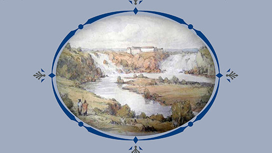
About 20,000 years ago, the Laurentide Ice Sheet’s two-miles-thick glaciers reached its maximum extent over North America. As it melted, about 17,000 years ago, it formed glacial Lake Agassiz. The Glacial River Warren emptied this lake down the modern Minnesota River and connected with the much smaller Mississippi River. Over centuries, the River Warren flow was about 26 million to 96 million gallons per second, at its highest 168 million gallons per second. As the great melt occurred, the lake’s southern outflow was catastrophic, and the Mississippi and Minnesota Rivers entered their most confined stretch at Bdote. Glacial terraces rose more than 100-feet above the river. The gorge-filled waters topped bluffs, and a great waterfall (Niagra!) was created at the current site of Downtown St. Paul.
Over 7,800 years powerful erosion forced the falls to retreat back through the West End. At Bdote-Fort Snelling the falls split: the River Warren receded west in the Minnesota River valley and dissolved; the Mississippi River waterfalls retreated to Saint Anthony. This Mississippi River gorge is the only true river gorge on the entire 2,350-mile length of the river.
Erosion of our riverside bluffs and rock date from this time. The lowest, St. Peter Sandstone, is off-white and weathers smooth. It lacks natural cement, making it easily eroded and excavated and useful for glassmaking. Henry Ford’s 1920s assembly plant in Highland Park took advantage of this in excavated tunnels. The next thin gray/brown layer is called the Glenwood Formation. The upper layer, Platteville Limestone, is grayish to yellowish and projects out over sandstone. In the Twin Cities it is a very durable formation about 30 ft thick leaving the West End with a lot to be quarried. Fossils of shelly animals are common in the Platteville.
The bluffs were separated between the West End and West Side with many backwaters or sloughs. Before 1800, one could cross the river at low water levels and lazy flow—but not during spring floods! Above the bluffs, the plateau of the West End became inaccessible and uninhabitable for Native tribes. Its limestone foundation became a morass of densely forested bog and swamp, further drained by streams from today’s Summit and Highland. There were only two breaks in those bluffs. The most accessible was at Phelan Creek below Mounds Park, the Lower Landing. Here métis voyageur boatmen who worked at Mendota in the fur trade had small farms. Prior to that primitive settlement, Native tribes held sacred the cave below, Wakan Tipi (Carvers Cave).
The Upper Landing would not be “discovered” until the arrival of John Irvine.
Details thanks to John Anfinson, author of “River of History” (2005).
You can find a copy of “The Origin Story of Fort Road/West Seventh Street, the Township/City of Saint Paul, the Territory/State of Minnesota: Glacial Age Forward” at your local library. Learn more about the book and find Joe’s upcoming conversations about the history of West 7th at josfland.com.


Leave a Reply