There is a misconception that the City of St. Paul grew out of a downtown district. Through the 1800s nothing could be further from the truth—both then, and now. Rather two breaks in the bluffs of the Mississippi River set history in motion. They became the Lower and Upper Landings and hubs of the future city.
The Mississippi river gorge’s bluffs were carved out by the great melted floods of the glaciers. The shores and terraces above were littered with bogs, marshes and the Great Woods. Between the confluence at Bdote and Phelan Creek, no Native villages lined the eastern bluff of the Mississippi: the bluffs were inaccessible and inhospitable.
In the early 1800s French and Native fur traders, the métis, settled the Lower Landing in small farms out of Mendota near the Dakota village of Shák’pí/Shakopee. The language was a mix of French and Dakota, though they were soon overwhelmed by American entrepreneurs and speculators from the east. The métis left to found Osseo and Little Canada, leaving the Americans and the English language to predominate. When the American Fur Company went bankrupt under Henry Sibley in 1842, the Lower Landing rose in prominence as a more accessible transportation hub though it was swampy and subject to flooding.
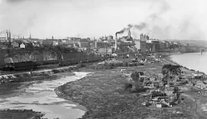
Riverfront topography became altered to provide access for the wagons up the bluffs and for steamship landings. At the Lower Landing, Baptist Hill was leveled at the foot of Jackson Street. Its soil and rock were used to fill its wetlands in preparation for the warehouses to come. It was the northernmost accessible landing between the Mississippi River’s 80-foot high bluffs and became a center for transportation, manufacturing and wholesaling companies serving the entire Upper Midwest. James C. Burbank’s Northwestern Express Company wharf boat and storehouses began at the Upper Landing, but in 1855 he relocated to the Lower. His contemporary, James Jerome Hill (1838 –1916) likewise centered his Great Northern Railway.
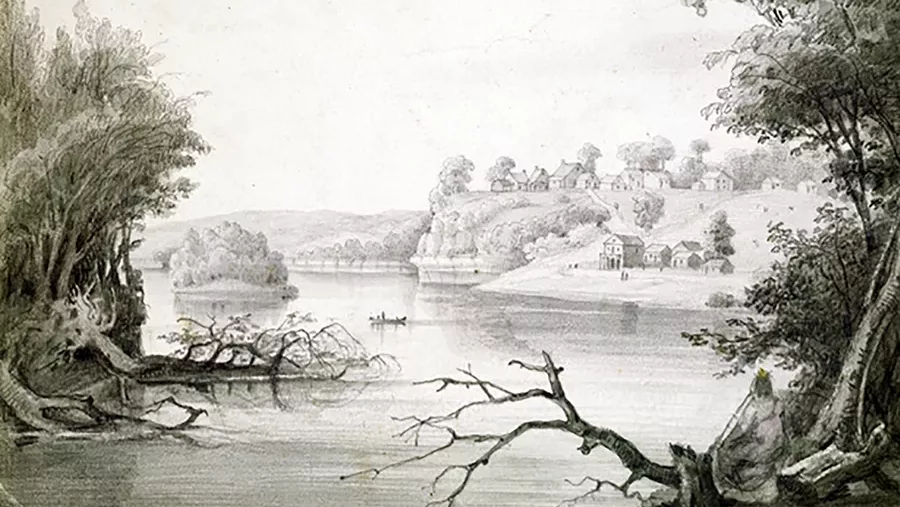
The Upper Landing had a different trajectory. The first claimants were evicted settlers from Fort Snelling in the 1830s, Fountain Cave south. John Irvine (1813–1878) developed the second break in the bluffs, the Upper Landing. His friend Henry Jackson convinced him of commercial opportunities at the head of Mississippi River navigation. In 1843 Irvine trekked 200 miles from Prairie du Chien in a sleigh with goods for sale. He dragged his supplies up the thickly wooded, roadless hill that became Eagle and Chestnut Streets. Within five years, Irvine cleared stands of elm, cedar and tamarack that he sold to passing wood-fired steamers. He processed lumber in his sawmill and built his home, the first frame building of the settlement.
While the Lower Landing became a commercial center, by contrast, the Upper Landing and its attendant Seven Corners became Saint Paul’s Ellis Island. First to arrive were German, Polish and Czech/Slovaks. The river flats provided land for primitive shacks until employment enabled a move up the bluff. Immigrant labor fostered meat packing, quarry and agricultural industries that served a growing center at Seven Corners—and the area between the landings. Governors, supreme court justices and mayors briefly had great homes along Fort Road/West Seventh, but human and industrial waste polluted the river, prevented flow, deprived oxygen and produced smell and disease. The wealthy fled to the summit.
At both landings, sloughs and back waters were filled in to create a stable land mass for access roads and warehouses. Impeded by the bluffs, settlers traveled between the two landings in river vessels, and “Upper Town” and “Lower Town” engaged in intense rivalry for commerce. The bluff between was blasted out for a direct connection along the riverside. Steamboat arrivals in the 1850s were a cause for celebration and opened communication with the rest of the world after months of frozen isolation. By the 1860s Saint Paul’s leaders began to develop a rail system to eliminate the city’s dependence on the Mississippi. Before an all-rail connection to the east was established in 1872, the railroads fed the river traffic rather than competing with it.
On the bluff the midtown area of the Township of St. Paul bridged the landings with service centers: a Catholic Church (1841), school (1847), newspaper (1848), territorial capital (1849) and courthouse (1851). Its residential area served its commercial centers, with small business and administrative centers providing service links that would significantly grow in the decades ahead.
In the 21st Century the re-population of the midtown of St. Paul will need similar connectors for its current, urban nodes. A transit circulator will facilitate travel between them: to the FURTHER EAST: St. Paul Brewing and Hamm’s complex; EAST: Lowertown amenities of Mears Park, CHS Field and Union Depot; NORTH: the State Capitol complex; WEST: Rice Park, City Hall, Landmark Center, Grand Casino Arena; FURTHER WEST: cultural centers of the CSPS Hall and Schmidt Brewery as well as its stretch of 19th Century commercial buildings. Lessons of the past could reinvent transit, and the midtown/downtown of today.
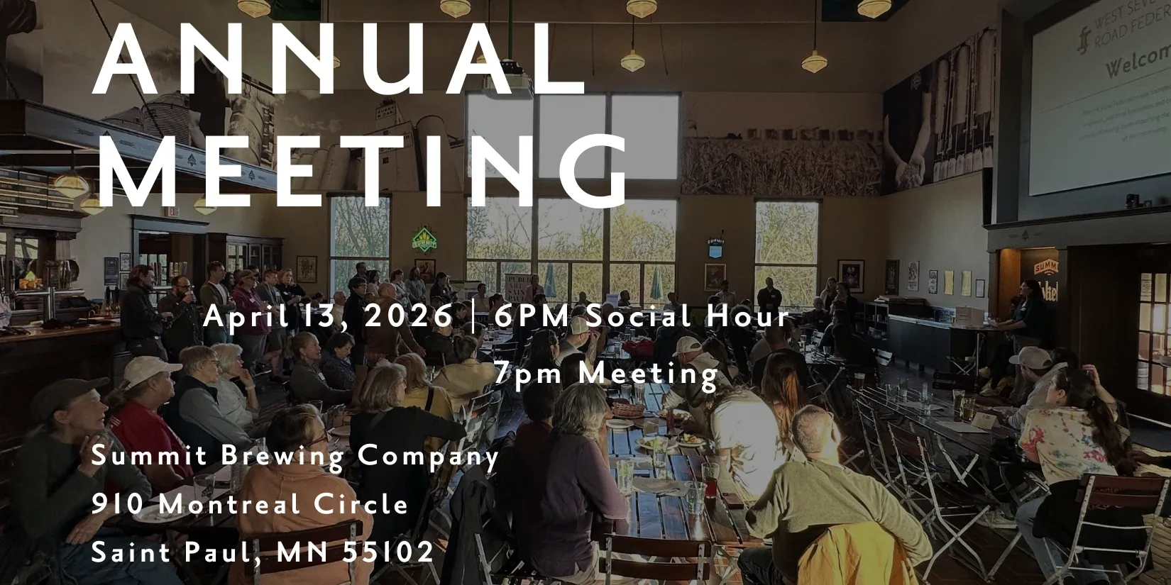
You can find a copy of “The Origin Story of Fort Road/West Seventh Street, the Township/City of Saint Paul, the Territory/State of Minnesota: Glacial Age Forward” at your local library, or order up a copy of your own at fortroadfed.org. Learn more about the book and find Joe’s upcoming conversations about the history of West 7th at josfland.com.


Leave a Reply